About Us
NH GRANIT (Geographically Reference Information and Analysis), New Hampshire’s statewide geographic information system (GIS), is a cooperative project to create, maintain, and make available a digital geographic database serving geospatial information to state, federal, regional and local decision-makers. The system was initiated in the mid 1980’s as a collaborative effort between the University of New Hampshire and the NH Office of Strategic Initiatives (f/k/a Office of Energy and Planning). Participation now comprises the major agencies active in resource mapping in the state, including state agencies, regional planning agencies, municipalities, and non-profit organizations.
As the state’s official GIS clearinghouse, NH GRANIT provides a suite of geospatial services to its participating agencies as well as the public at large. These services include access to a comprehensive, regularly updated spatial database, development of applications using the database, maintenance of online mapping capabilities, provision of training to agency personnel, and general technical support to the state’s GIS community. GRANIT’s role as the state’s GIS repository promotes rapid and efficient geospatial data discovery by a broad range of stakeholders in the state and the region, ensures that users access the most current and comprehensive version of each data set, and eliminates inefficient, expensive, and redundant data storage, all of which help to ensure that decision-makers have rapid access to current, comprehensive, and accurate geospatial data.
Since its inception, NH GRANIT services have supported a wide array of mapping and resource management applications in the state and the region, including:
- Critical facilities and hazard (floodplain) mapping
- Transportation corridor planning
- Statewide land cover assessments
- Broadband availability inventorying
- Wildlife habitat mapping and analysis
- Service area analysis
- Energy facility siting
- Strategic land conservation planning
- Watershed management/impervious surface mapping
- Natural resource assessments
- Community master planning
- GRANIT staff maintain the NH Broadband Mapping & Planning Program, a comprehensive program that seeks to understand where broadband is currently available in NH, how it can be made more widely available in the future, and how to encourage increased levels of broadband adoption and usage. We are currently funded by the Northern Border Regional Commission to map, monitor, and assess availability in northern NH, as well as to work with local organizations to promote enhanced services.
- In partnership with UNH Cooperative Extension and with funding from the USDA Forest Service and the Town of Randolph, NH, GRANIT staff are working to develop a new web mapping tool entitled “Dirt to Trees to Wildlife”. The tool seeks to assist land/resource managers by allowing them to define an area of interest, inventory the soils within that area, identify the forest types that can be supported by those soils, and ultimately, understand and manage for wildlife that could use those forest types as habitat.
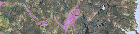
- GRANIT is a FEMA Cooperating Technical Partner, and is currently working on the hydrology and hydraulic analyses required to update floodplain maps for 26 communities in Rockingham and Strafford Counties.
- GRANIT is collaborating with NH Department of Environmental Services to ensure that there is statewide LIDAR coverage for NH, and to manage and distribute the existing LIDAR data for the state. The effort also involves generating a suite of derivative products from the LIDAR collections, most notably contours.
For a comprehensive listing of our past projects, please see our Archived Projects page