Sound travels efficiently underwater, and acoustic and oceanographic observation informs environmental monitoring of animals and other signal processing activities. Effective sound transmission in the marine environment is affected by the physical and chemical properties of seawater and seafloor composition, as well as human-generated sound. Sustained observations and measurements at multiple spatial and temporal scales improve our understanding of interlinked systems, from seafloor to sea surface and from shore to the shelf edge. In addition to currently deployed acoustic and ocean observation assets across the Gulf of Maine, the project conducts localized measurements of seabed acoustics and geoacoustics, and investigates the unique and complex interactions of very shallow water processes in relation to more offshore acoustic dynamics.
Updates from the project's first research cruise, AR103
29 September 2026
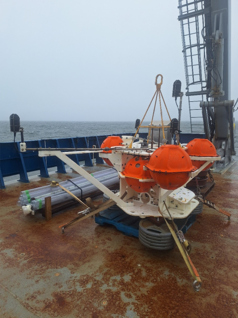
ALTO lander with anchor on the deck of the R/V Neil Armstrong. Photo credit: Robert Mills
What is an ALTO?
Howdy all, my name is Robert Mills, I’m one of the few non-scientists involved in the science team. You might be wondering what I’m doing out here if I’m not a scientist, well my job is as mooring technician. I’m responsible for safely deploying and retrieving UNH’s Acoustic Long Term Observatory (ALTO) lander.
The ALTO is a lander/mooring developed for UNH for long-term Passive Acoustic Monitoring (PAM) while including a package of various other sensors. JASCO Applied Sciences (whom I work for) designed the lander to include their Autonomous Multi-channel Acoustic Recorder- Ultra Deep (AMAR-UD) acoustic recording system. The AMAR UD is a 6000m depth-rated acoustic data logger that can record up to 4 channels at various frequency rates for up to a year. The ALTO landers also allow us to track directionality of acoustic detections through an orthogonal array spacing of the four hydrophones mounted to the deck of the ALTO.
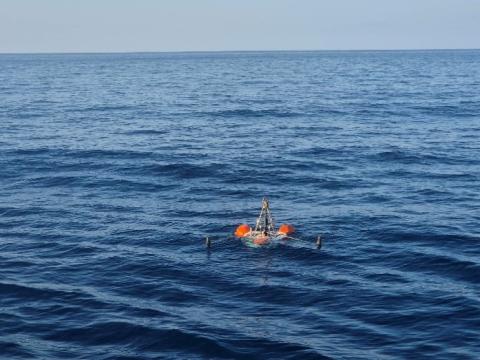
An ALTO lander on the surface after releasing its anchor. Photo credit: Robert Mills
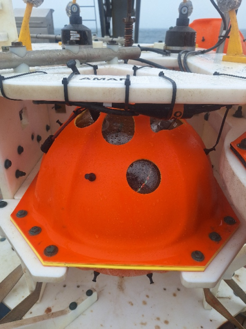
Close-up image of an AMAR in a glass sphere. Photo credit: Robert Mills
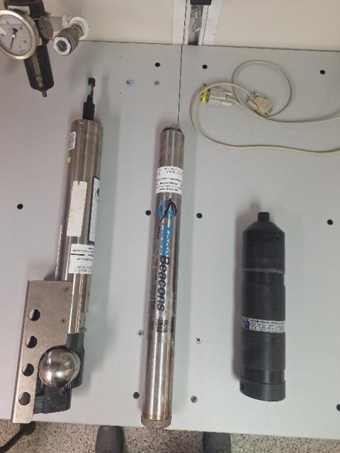
MicroCat CTD, Apollo GPS beacon, and VEMCO fish tag logger. Photo credit: Robert Mills
Along with the AMARs, a diverse sensor payload is also deployed. For this project we’ve mounted sensors like a VEMCO fish tag logger that allows us to see if tagged fish have passed by, a Sea-Bird MicroCat CTD that allows us to look at local oceanic conditions specifically Conductivity, Temperature, and Depth (Where CTD comes from), and upward looking sonar packages like Kongsberg Wide-Band Autonomous Transceiver (WBAT) we are using to look at the water column, and the ASL Acoustic Zooplankton and Fish Profiler (AZFP) used to look at zooplankton and fish densities in the water column above the ALTO.
Currently JASCO is working on ways to fit new and varied deep water sampling systems like eDNA samplers, click detectors, and even plankton sampling systems to look at a broader range of subjects in local marine ecosystems.
Robert Mills
JASCO Applied Sciences
28 September 2026
How did we get here?
18 months ago I was asked if it would be possible to use the SEABOSS at depths of around 300 meters. After saying yes, I don’t think I understood exactly what I was getting myself into. Fast forward 18 months later and several successful SEABOSS deployments to over 200 meters of depth, and it has been quite the process.
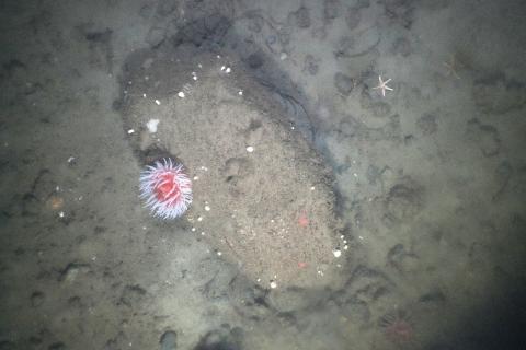
Achieving record setting SEABOSS depths. Photo credit: Pat Berube
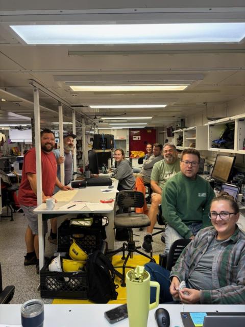
The people that made it happen (minus Laura). Photo credit: Pat Berube
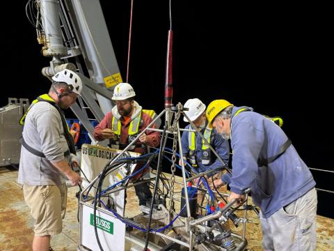
Hopefully it doesn't break. Photo credit: Pat Berube
The SEABOSS consists of a forward-looking camera, a downward looking camera, a still camera, altimeter, and a depth sensor. The biggest challenge is how to maintain connection to these instruments using a cable over 100 meters, requiring a switch to fiber optics. Making a change this large requires a lot of people to venture outside their comfort zone and trust one another to ensure that the deadlines and milestones were being met. This was a project of a scale that our group at the USGS Woods Hole Marine Science Center had not undertaken in my time there.
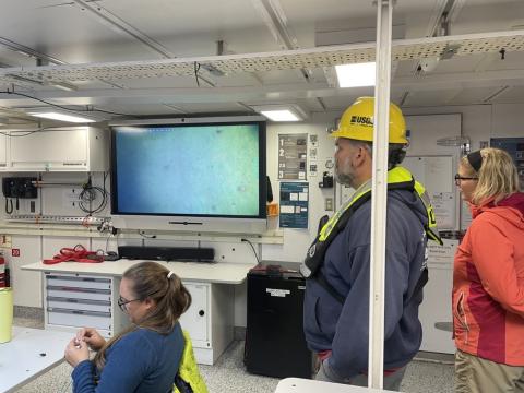
SEABOSS on the big screen. Photo credit: Pat Berube
The preparation for the Gulf of Maine mapping cruise was also a huge departure from what we are used to as well. There was no shortage of questions asked and problem scenarios discussed resulting in a three-page packing list and a back up plan of GoPros and zip ties. The amount of new, unfamiliar equipment required to maintain or fix a fiber optic system definitely adds a few more pelican cases. There has been no shortage of breath holding and finger crossing along with wondering after which SEABOSS deployment will give the warm and fuzzies of this thing actually works. When the rest of the science party is huddled in excitement around the TV in the lab and the cool pictures folder on the work station folder fills up, the decision made 18 months ago was definitely worth it.
Pat Berube
United States Geological Survey
27 September 2026
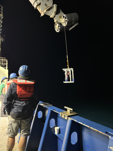
Figure 1: The ZIPPER being deployed off the starboard side of the boat at night on AR103. Photo credit: Paige Tortorice
"What zooplankton do in the shadows"
As a research technician in the ALES lab at Stony Brook University, I have had the privilege of coming aboard the RV Neil Armstrong for this 21-day adventure in the Gulf of Maine. We are officially two weeks in and there has been so much interesting science happening on the boat, as well as thrilling card games and delicious food! Part of my responsibilities on this trip is to deploy our instrument called the ZIPPER (Zooplankton Imaging and Physical Profiler for Ecological Research; Figure 1). It consists of the RBRconcerto CTD, collecting a variety of water variables such as conductivity, temperature, and depth, and the WASSOC Shadowgraph V3, which is an underwater imaging system capturing silhouette images of zooplankton.
Usual zooplankton sampling methods include net tows, similar to the vertical ones we also do (see earlier post from September 16!). However, is it difficult to say exactly what depth the zooplankton collected in a net were when we scooped them up. An advantage of the ZIPPER is that we know where in the water column certain zooplankton are, and we also know what their environment is like with data from the CTD!
We have made our way through 3/4 of our Gulf of Maine sites so far, doing vertical zooplankton net and ZIPPER tows at each location. Due to the nor’easter, we are currently hiding out in Cape Cod Bay for a few days and had the opportunity to do some sampling here as well. We have captured many different organisms over all of our deployments, such as copepods (Figures 2 & 3) , chaetognaths (Figure 4), siphonophores (Figure 5), and krill (Figure 6) to name a few. Some highlights from the ZIPPER can be seen in the images below!
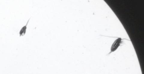
Figure 2: Copepods imaged during a ZIPPER tow on AR103. Photo credit: Paige Tortorice
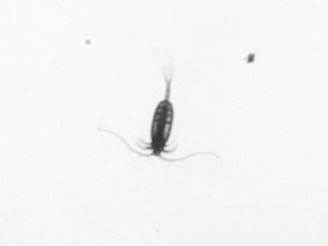
Figure 3: Another copepod imaged during a ZIPPER tow on AR103. Photo credit: Paige Tortorice
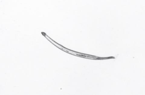
Figure 4: A chaetognath captured from a ZIPPER tow on AR103. Photo credit: Paige Tortorice
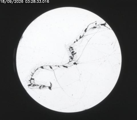
Figure 5: A siphonophore chain was imaged during a ZIPPER tow on AR103. Photo credit: Paige Tortorice
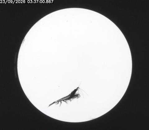
Figure 6: A krill imaged during a ZIPPER tow on AR103. Photo credit: Paige Tortorice
Other than working, I have been enjoying the beautiful sunrises (Figure 7) and sunsets (Figure 8) that we get to see every day. We take off back into the Gulf of Maine later tonight to finish up at our last site this week. Fingers crossed we see many more cool things this week!
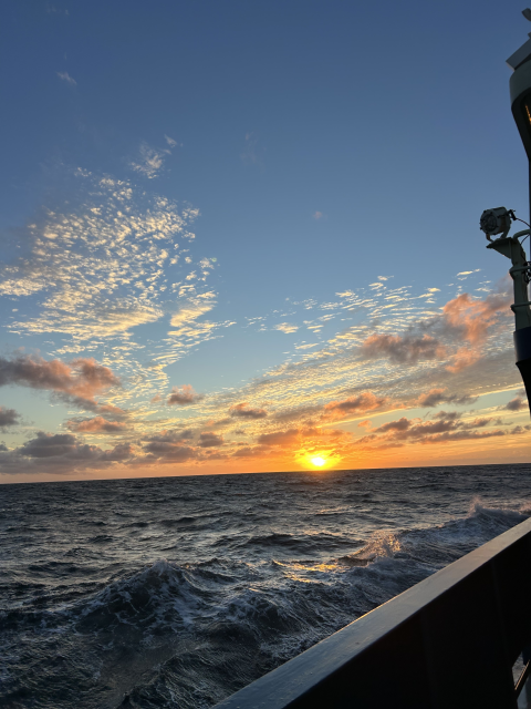
Figure 7: Sunrise on AR103. Photo credit: Paige Tortorice
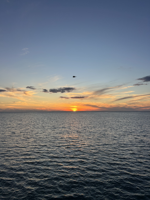
Figure 8: Sunset on AR103. Photo credit: Paige Tortorice
Paige Tortorice
Research Technician | Warren Lab, School of Marine and Atmospheric Sciences, Stony Brook University
26 September 2026
The Backbone of Acquiring Data
Life on the R/V Neil Armstrong is always changing and adapting to new tasks at hand. While all the data is being recorded and analyzed, there is a larger respect to the mechanical hardware needs that that allows us to collect the data. Our team has been deploying acoustic moorings that allow us to record passive acoustics below the surface. Without the robust design of the measurement hardware, none of the data would be collected and analyzed.
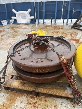
Figure 3. Photo credit: Matt Seyler
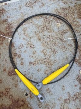
Figure 2. Photo credit: Matt Seyler
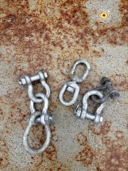
Figure 1. Photo credit: Matt Seyler
Out on the water, some of the most important equipment is also the easiest to overlook. Boats and moorings both depend on components designed to connect, secure, and support. Among these are four deceptively simple tools: shackles, cables, anchors, and buoys.
Shackles, cables, anchors, and buoys may seem unrelated at first, but they are often used in the same at-sea measurement systems. The result is a system in which each part has a distinct role:
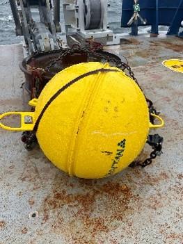
Figure 4. Photo credit: Matt Seyler
- Shackles connect (Fig 1).
- Cables withstand loads (Fig 2).
- Anchors hold the equipment in a specific location (Fig 3)
- Buoys mark, provide floatation, or provide a visible reference point (Fig 4).
The individual components may be simple, but their reliability can be critical to the system as a whole. Shackles, cables, anchors, and buoys rarely receive the attention given to boats, ships, or offshore structures. Yet they demonstrate an important engineering principle: Reliable systems depend on reliable connections.
Together, these humble pieces of equipment help connect the physical world above and below the waterline—and remind us that sometimes the smallest components deserve the closest attention.
Marine equipment has to contend with conditions that can be considerably tougher than those found on land. Saltwater promotes corrosion, waves create constant movement, and changing loads can place repeated stress on hardware.
The individual components may be simple, but their reliability is critical to the system as a whole. Each component has its own ratings - whether those ratings be working load limits or depth ratings. Each of the ratings must come together to ensure a safe deployment and recovery of all of our equipment.
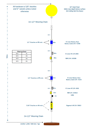
Figure 6. Image credit: Matt Seyler
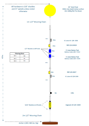
Figure 5. Image credit: Matt Seyler
On this cruise, we are using a few variations of acoustic mooring arrangements (Figure 5 / 6). Each design has its own special characteristics that allow for deployments at various ocean depths. The acoustic mooring designs have various passive acoustic and temperature – depth sensors attached. These designs allow us to record data accurately for post processing. Without mechanical hardware none of our work would be possible.
In closing, we all owe a level of respect to mechanical hardware and its ever-changing designs and strengths that allow us to continue collect data to address science questions.
Matt Seyler
The Pennsylvania State University
Previous posts from research cruise AR103
What do scientists do at sea when they can’t do science?
On an expedition such as this one aboard the Research Vessel Neil Armstrong, scientists inevitably have down time where they are waiting to do the science while they are on board. This happens while transiting between sampling sites, waiting while other scientists on board are doing their work, such as mapping transects, having to discontinue science operations because of weather, or just waiting to deploy equipment. What do these scientists, engineers and crew do during their spare time you may ask? Sometimes it’s just normal hobbies or routines, others are specific traditions people have picked up at sea, and some are just fun activities to keep up the morale on board. I decided to take this opportunity to document some of the fun things I’ve found people doing at sea during this cruise:
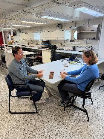
Chief scientist Jen and Co-PI Tony (UNH) playing cribbage, a highly important daily ritual. Photo credit: Kyle Aaron
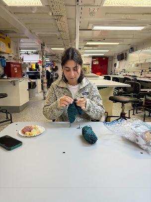
Lab technician Paige (Stony Brook University) crocheting some kind of tapestry. Photo credit: Kyle Aaron
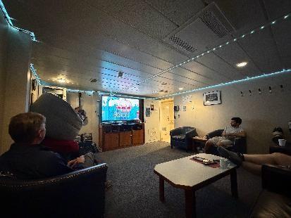
The captain and some of the crew enjoying their daily video game time together. Photo credit: Kyle Aaron
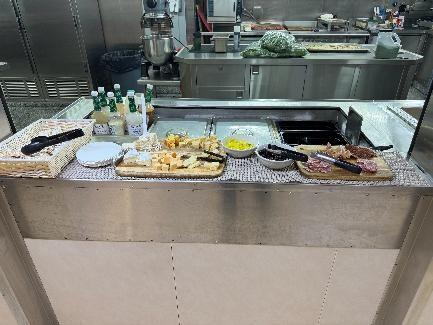
The stewards on board serve what they call Cheese-thirty, where they serve charcuterie every day at 2:30, including very tasty cheese. Photo credit: Kyle Aaron
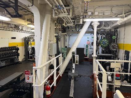
The gym on the Armstrong is one of the best of any research vessel. Photo credit: Kyle Aaron
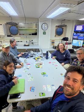
Playing Monopoly Deal with several other science party members, a fun tradition some of us have. Photo credit: Kyle Aaron
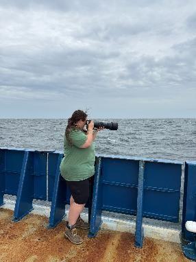
PhD student (UNH) Daryll takes photos of birds and sometimes sharks or Mola Mola. Photo credit: Kyle Aaron
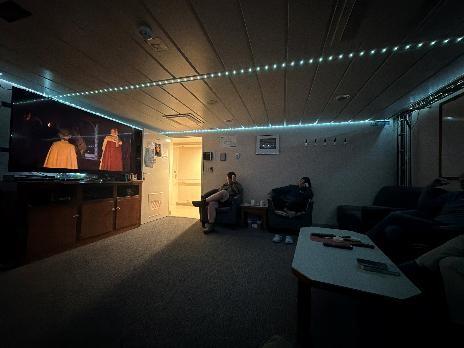
Some of the science party enjoying a movie night! Photo credit: Kyle Aaron
As you can see there are plenty of activities we can do aboard to stay optimistic and keep up morale while we conduct important scientific work!
Kyle Aaron, Ocean Engineer
JASCO Applied Sciences
Getting to the Core of the Problem
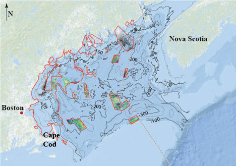
Figure 1. Map of the Gulf of Maine showing the general location of the study area and the extent of previous geophysical surveys. Image credit: Kelli Moran
The Gulf of Maine is a portion of the Atlantic Ocean that encompasses an area of the Northeast U.S. from Cape Cod, MA in the south to Nova Scotia in the north and covers approximately 36,000 square miles. Despite its extreme size and proximity to major port cities like Boston, MA and Portland, ME, we know fairly little about the geology underlying this marginal sea. Recently, portions of the Gulf of Maine have been mapped using modern mapping techniques – see the red polygons in Figure 1. However, those mapping efforts are spread throughout the basin and only provide small snapshots of the larger picture. It’s like we’re trying to build a puzzle when we’re missing half of the pieces. What we do know is that the Gulf of Maine has experienced several instances of glacial advancement and retreat throughout its more recent history (~20,000 years) and those processes have left a complex geologic puzzle for us to piece together.
Scientists from the U.S. Geological Survey are aboard the R/V Armstrong to collect some of those missing puzzle pieces in the form of sediment samples. We have been hard at work collecting both Piston and Gravity cores (Figure 2) as well as surficial sediment samples from the sea floor (Figure 3) in the same areas where we, and the other research teams aboard, are collecting extensive geophysical data.
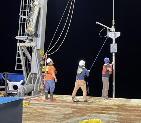
Figure 2: Eric Moore, Alex Nichols, and Kent Sheasley deploying the U.S. Geological Survey’s piston corer aboard the R/V Armstrong. Photo credit: Seth Ackerman
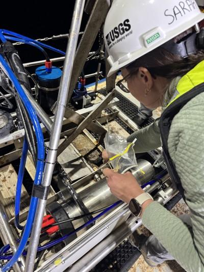
Figure 3: Sarah Widlansky subsampling a surficial sediment sample collected by SEABOSS. Photo credit: Kelli Moran
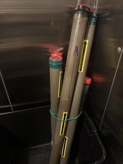
Figure 4: Sediment cores stored in the walk-in refrigerator so they can be preserved until they make it back to the Sediment Lab at the Woods Hole Coastal and Marine Science Center. Photo credit: Kelli Moran
In essence, we are expanding the map and improving our interpretations of that map. Once we have the sediment samples on board, they get sub-sampled, labeled, and stored in the walk-in refrigerators (Figure 4) aboard the Armstrong until we can get them back to the Sediment Lab at the Woods Hole Coastal and Marine Science Center for analysis.
A quick assessment of the surface samples has confirmed that large areas of the Gulf of Maine have a thin layer of marine mud atop a thick deposit of glacial till—a poorly sorted (grain sizes ranging from muds to boulders) material that is extremely difficult to core through or collect samples from. Once we get the results back from the Sediment Lab, we will be able to use all of our sediments data to better interpret the multibeam bathymetric, backscatter, and subbottom surveys the research teams have collected throughout the cruise, giving us the clearest picture of the geologic history and current conditions across the Gulf of Maine to date!
Kelli Moran
United States Geological Survey
Why am I spending this cruise in a refrigerator?
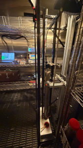
The cold room at 4 °C: a core mounted in CARL, with the laptop and the oscilloscope on the shelf behind it. Photo credit: Judith Elliot-Adjoh
Off the wet lab of the Armstrong there is a cold room holding at 4 °C. Inside it: a rack of sediment cores, a laptop, an oscilloscope, a squeeze bottle of glycerin, and me.
I am a PhD student at UNH, and my job on AR103 is running CARL, the Core And Resonance Logger, which measures how fast sound travels through mud and how much of it the mud swallows on the way.
The cold is not for the mud’s comfort. Sound speed depends on temperature. Every measurement I make on a core gets compared against one made in a tube of clean water, so the core, the water and the instrument all have to sit at the same temperature. A core scanned warm against a reference measured cold gives a number that means nothing. So, each core rests in the cold room for a full day before I touch it. It cools. Small bubbles dissolve back into the water. Nobody opens the door more than they have to.
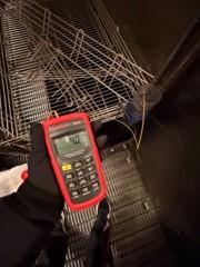
Four degrees, read off a thermometer sitting in a beaker of water that has been in the cold room as long as the cores have. Photo credit: Judith Elliot-Adjo
The first mud came up in short clear tubes 6.5 cm across. The seafloor at that site was too sandy for a piston core, so our USGS colleagues pushed the tubes by hand into sediment that SeaBOSS brought up in its grab. Later sites have given us the long sections, gravity and piston cores cut into meter lengths and labelled by hand on deck in the middle of the night.
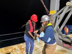
Working up a push core sample on the back deck. Photo credit: Laura Brothers
Capping a core is its own small skill. Push the cap straight on and you drive the trapped air down into the sample. Instead, you hold a flathead screwdriver against the inside of the liner, seat the cap over it, and let the air escape past the blade.
Then, there are two ways to listen.
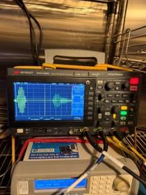
The pulse sent into the core, and the same pulse arriving on the far side. The gap between them is the measurement. Photo credit: Judith Elliot-Adjoh
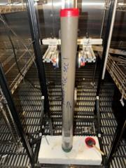
A gravity core section mounted in CARL, with a transducer on each side ready to travel down it. Photo credit: Judith Elliot-Adjoh
1. Time of flight. Two oil-filled pads squeeze the tube from either side. I brush on glycerin thinned with water, so the sound has a path through the plastic, because straight glycerin goes stiff in the cold. One pad sends a pulse across the mud. The other times its arrival. The pair steps down the core, every centimeter on the short ones and every two on the long ones. Divide the width of the tube by the travel time and you have a sound speed. So far, sound crosses this mud 1 to 4 percent faster than it crosses seawater.
2. Resonance. This is the one I came for. A small piston sits on the sediment surface and shakes it, and the whole column of mud rings. The pads slide down the tube listening to the pattern that sets up inside. On one core the ringing came back strongest near 14 and 17 kilohertz.
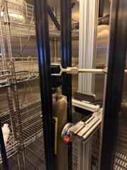
The piston that shakes the core, lowered onto the sediment surface. Photo credit: Judith Elliot-Adjoh
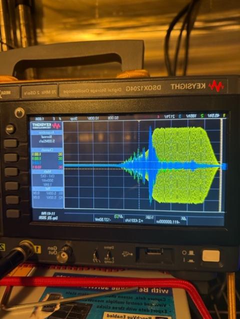
The core ringing, and the ringing dying away, captured on the oscilloscope. Photo credit: Judith Elliot-Adjoh
Those numbers are the reason I am in the fridge at all. Under our hull, the ship’s echosounder pings the seafloor at 18 kilohertz, and the echoes that come back carry clues about what the bottom is made of: mud, sand or gravel. My research at UNH turns echoes like those into maps. But a map is only as good as your way of checking it, and most core loggers work at hundreds of kilohertz, far above the frequencies the echosounder uses. CARL reaches down into them.
Meanwhile the sediment lab samples the same cores every 2 cm, the spacing we agreed on before the first core came aboard, so their physical measurements land at exactly the depths where I have acoustic ones.
So, these tubes are my answer key. Each one is a piece of seafloor I can hold and measure, then set against what the sonar heard from the surface.
The next core has been cooling since yesterday. Time to go back in the fridge!
Judith Elliot-Adjoh
PhD Student, Ocean Engineering, University of New Hampshire
Two lessons from my first time at sea:
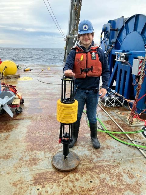
Photo credit: Chad Smith
- Be flexible!
Everything beyond 48 hours ahead of the current moment (if not less) is up in the air. The planning board is called the “Board of Lies” for a reason. This is even more the case when a Nor’easter is on its way halfway through the cruise. Maximizing our time spent at sea is not only about careful planning, but also being willing to adjust these plans, whether because of technical difficulties, or because the environment inspires new ideas. For an example of the latter (because it is more fun), yesterday my advisor (Chad Smith) came up with the brilliant idea to leave one of our temperature and pressure sensors at the bottom of the Gulf of Maine for at least a year to collect long-term data, and I had to get that sensor ready to deploy in a way where its single AA battery would last for 28 months. We then deployed that sensor first thing this morning on a TOSSIT (shown to the right).
- Equipment is not guaranteed to survive the ocean in one piece (or even come back).
While this may seem obvious considering that the ocean is a vast and often unfriendly place, it is easy to think the robust scientific quality sensors we use should hold up to this unforgiving environment. However, it only takes a little time at sea to find this is not always the case. Many of the scientists on board have at least one, if not multiple, stories of equipment failing to surface from the bottom of the ocean. However, these were usually the result of acoustic anchor/release mechanisms failing or storm event.
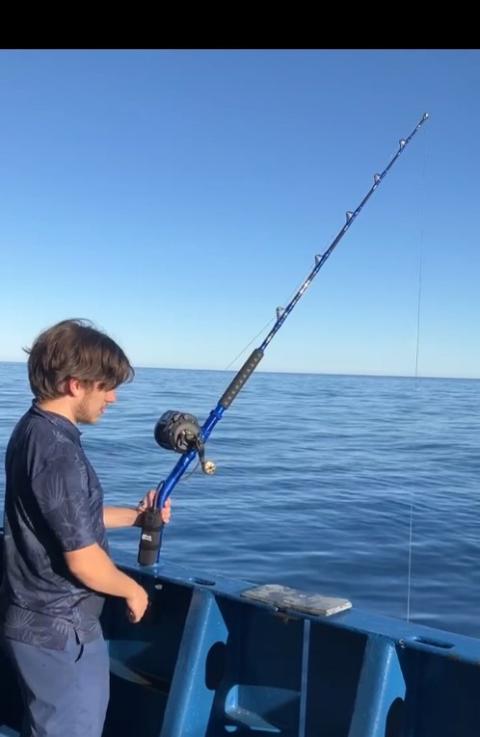
Photo credit: Chad Smith
Throughout our trip, we have been using several methods to understand how the speed of sound in the ocean evolves with depth at our various experiment locations. The sound speed profile has a dramatic influence on how sound travels through the ocean. When the ship is stopped, we perform a measurement using a CTD, standing for Conductivity, Temperature, and Depth (derived from pressure), the three of which help dictate the speed of sound at a given depth. One way to deploy and retrieve this sensor, is to lower it into the water and then raise it from the bottom using a heavy-duty fishing rod with an electric reel. After days of doing this, Chad, who was running the fishing rod, felt a strong pull and watched as the line sped away from the ship, as though a fish or some other marine life had grabbed the line. Once the end of the line surfaced, there was no CTD left. It had been grabbed (though unlikely eaten), by a shark, whom crew on the bridge named “Kevin”. According to Chad, this was the first time he had lost a sensor. In a way, I feel honored to have been present for such a moment. Going back to my earlier point about flexibility, we had to go without additional CTD data from this sensor, but luckily the ship has a CTD and we are substituting XBT (temperature depth) profiles to get the sound speed information. We also had to postpone several of our other measurement locations, moving on to some that were later on the schedule in order to get away from the now several sharks surrounding the vessel.
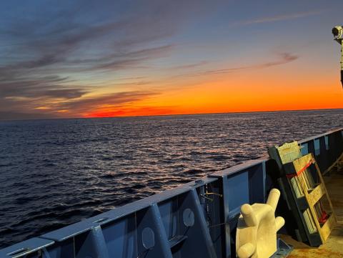
Photo credit: Jack Lyons
To conclude, this trip has been an amazing learning experience for me, for which I am incredibly grateful. The fact that the work isn’t directly related to my thesis has removed some pressure and allowed me to take in the practical experience I am getting, learn from other scientists, and appreciate the beauty and scale of the ocean.
Jack Lyons
PhD Candidate, Penn State University
Nightwatch Crafting Hour, or How to Make Your Own Electronics Cables for Fun and Success
Is your deep-sea camera system on the fritz? Are your network failures and video glitches bumming you out? No more pixelated pictures of the deep! Let’s shake some gremlins loose and make a new cable! Here’s your step-by-step guide to fabricating a new cable at sea!
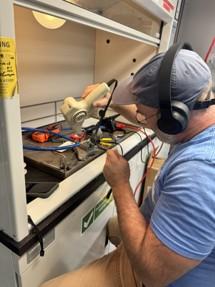
Your blog post author doing his thing. Photo credit: Eric Moore
- Choose a suitable spot. Ask the ship’s technician if there’s a suitable place to make a small mess. When they say “no” and send you back to the lab, set up your equipment in a nice, out of the way place where you’re the only person sniffing soldering fumes (preferably in a fume hood).
- Prepare your workspace. Assemble your tools, including wire strippers, snips, knives, multimeter, soldering iron, and heat gun. We’ll need solder, and heat shrink, and an electronics potting kit.
- Head to the galley for coffee and snacks, you’ll need to be fully caffeinated for this procedure.
- Back at your electronics bench at sea, begin preparing the cables. Tonight we’re connecting two “pigtails”, which are sections of cable with a wet-pluggable connector at one end, and bare wires on the other. Begin by cutting back the cable jacket to expose the wires, about two and half inches from the bare-wire end.
- Place your cable in something to immobilize it, like a vise. Two vises are ideal to hold each end of the cable. In a pinch (we were), tape can work too (it did).
- Twist the bare wire ends on each side together to join them, making sure to match their colors -wait, we need to place heat shrink on the wire before they’re joined! Unwrap the wires, place the heat shrink around the cable, and then re-twist them together. Forget to place the heat shrink on the wire about three or four more times for maximum enjoyment.
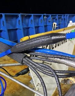
A finished cable, ready for action. Photo credit: Eric Moore
- Solder the wires together, then use then use your vintage heat gun to seal the heat shrink around the solder joints.
- Walk to the galley and get another snack while everything cools.
- Now we’re ready to pot (encase in plastic) the soldered wires, since our plan is to use this in the ocean. Your potting kit will have a mold and a pouch of two-part potting compound that you’ll pour into the mold. Tear the barrier separating the clear and black fluids and mix them together by squishing them around for about 30 seconds.
- Cut the pouch and pour its contents into the mold, working quickly but taking care not to pour too fast! The potting compound will bubble and ooze out of the seams you’ve forgotten to fully seal with tape like a primordial ooze, but you’re a good shipmate and have covered your bench with shop towels for easy cleaning.
- Wait twelve hours for the compound to cure, then unmold. Success! Maybe a celebratory trip to the galley is in order?
Eric Moore
United States Geological Survey
Why is almost all oceanographic equipment yellow or orange?
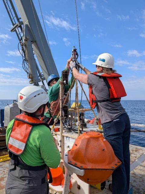
Photo credit: Tony Lyons
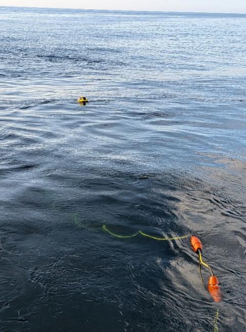
Photo credit: Tony Lyons
Short answer:
Buoys, floats, moorings and other oceanographic instruments that need to be recovered at sea after deployment, commonly have to be spotted from a ship's deck. Yellow and orange are used in the marine environment because they are highly visible “find me” colors. A yellow or orange object against dark water is far easier to find than dark colors like blue or gray or even white (the color of whitecaps).
Long answer:
Water absorbs red light first, then orange, then yellow as you go deeper. But near the surface and at moderate depths where most equipment operates or gets recovered, yellow and orange remain highly visible. The color of the sea, overcast skies, fog, rain, waves and times around dawn and dusk can make equipment surprisingly difficult to see in the water. Thanks to the physics of light absorption, yellow and orange equipment stands out strongly against the blue, gray, and green of seawater, making buoys, floats, moorings, and other expensive oceanographic gear easier to spot from a ship. Reflective tape and strobes are often added for the same reason.
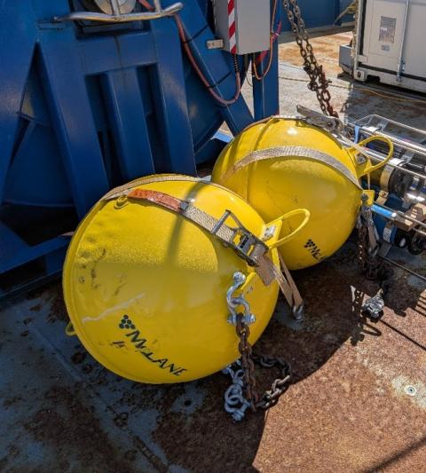
Photo credit: Tony Lyons
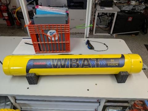
Photo credit: Tony Lyons
Once the yellow and orange colors became common in oceanographic equipment, they also became an informal visual convention: a yellow or orange buoy or instrument is immediately recognizable as something associated with oceanographic work or research. Orange and yellow are international safety colors — think life jackets and rescue gear — so the practice carried over naturally to marine hardware.
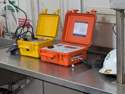
Photo credit: Tony Lyons
One caveat
Color doesn't behave the same way underwater as it does in air. Water preferentially absorbs longer wavelengths, so red disappears first, followed by orange and yellow as depth increases. Blue and green penetrate farther. Consequently, the brilliant orange or yellow color you see on a float at the surface may look very different—or nearly disappear—when viewed at depth because the water has filtered out those colors. Some deep-ocean equipment that does not have to be retrieved from the sea surface, like undersea telecommunications cables, may be black or other colors because surface visibility is irrelevant once they're hundreds or thousands of meters down.
Tony Lyons
University of New Hampshire
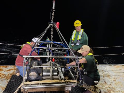
SEABOSS imagineers Alex Nichols, Seth Ackerman, and Lee Vanderveen prepare SEABOSS for deployment in the Gulf of Maine. Photo credit: Laura Brothers
CREATURES OF THE NIGHT: Team SEABOSS
What’s mysterious and only seen during nights on Cruise AR103? Answer: Team SEABOSS and the Gulf of Maine’s seafloor. Team SEABOSS is the group of scientists and engineers working on SEABOSS 3.0 (SEABed Observation Sampling System), the United States Geological Survey’s (USGS’s) seafloor sampler and imaging instrument. We’re here, with the rest of the science party, aboard the R/V Neil Armstrong trying to better understand the seabed.
Last night was the inaugural field work for SEABOSS 3.0—And it performed like a super star! This iteration of SEABOSS has high-resolution cameras, real-time navigation and motion sensors (depth, altitude, orientation), improved lighting, strobes and lasers, and most significantly, fiber-optic communication, which dramatically increases data bandwidth and allows real-time high-definition video and imagery to be streamed and recorded onboard. Despite some first night jitters, SEABOSS 3.0 hit it out of the park and allowed us to collect seabed samples, seafloor and water column imagery at 10 stations around the shallow Wilkinson Basin sites.
Below are photos of Team SEABOSS and images collected in 130-177 meters water depth. Enjoy!
Laura Brothers
United States Geological Survey
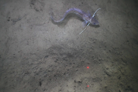
A red hake swims over muddy and rugged seafloor of the Gulf of Maine. Image from SEABOSS 3.0, provided by Laura Brothers
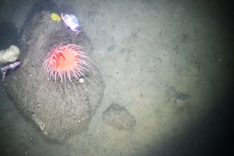
A boulder provides important habitat for anemone, sponges and fish. Image from SEABOSS 3.0, provided by Laura Brothers
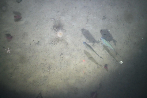
A sea star, sea pens, anemone, fish and their shadows(!) co-exist on the muddy and rugged seafloor of Jeffrey’s Ledge in the Gulf of Maine. Image was collected by SEABOSS 3.0, provided by Laura Brothers
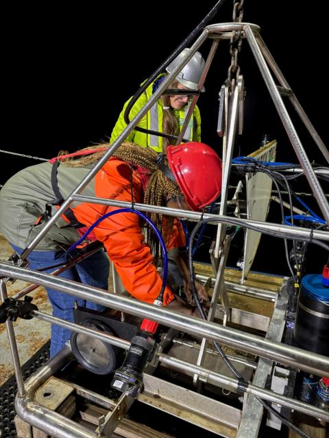
UNH graduate student Judith Elliot-Adjoh subsamples a SEABOSS 3.0 grab sample under the tutelage of Kelli Moran (USGS). Photo credit: Laura Brothers
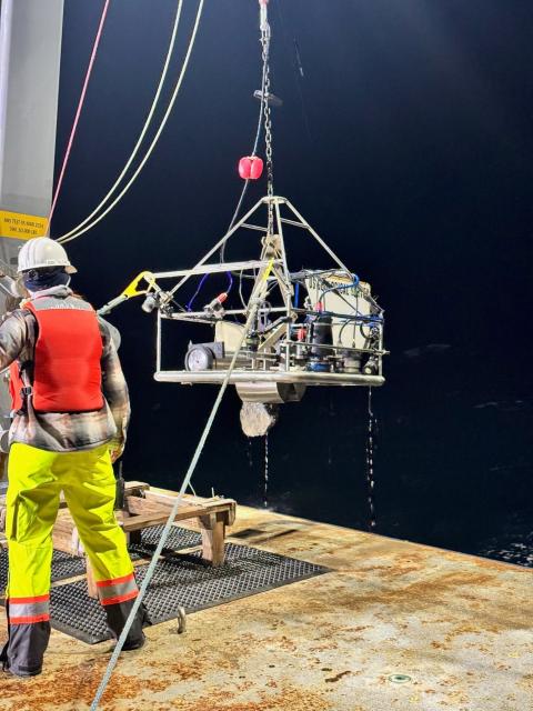
Boulder say what? Rocky seafloors are hard to collect physical samples from because the sampler mechanisms usually can’t clamp around coarse material, akin to how a claw machine arcade game almost, but not quite grabs the ducky you want. R/V Armstrong crew member, Sonia, leads the recovery of the SEABOSS 3.0 with an impressive boulder wedged in its sampler. Photo credit: Kelli Moran
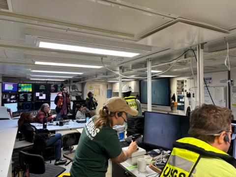
SEABOSS 3.0 dives became Must See TV. In the background, rapt Science Party members watch live SEABOSS 3.0 imagery of the seafloor, while Lee Vanderveen and Seth Ackerman pilot SEABOSS’s winch and control SEABOSS’s settings from the dry lab. With the help of the Ship’s science technician, SEABOSS 3.0’s video feed was piped throughout the Ship for all to enjoy. Photo credit: Laura Brothers
18 September 2026
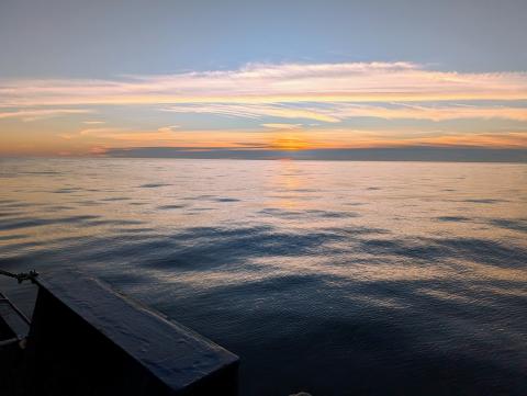
Every day we’ve had a beautiful sunset. Photo credit: Jason Philtron
Hello everyone! I’m Jason Philtron, an R&D Engineer with the team from Penn State. My role on this cruise is to organize our XBT (temperature profile of the water column) and CTD (temperature, salinity, and depth) casts, assist with THORA deployment and recovery (an acoustic receiving array with 128 underwater microphones called hydrophones all strung in a line), and perform in the field data analysis to make sure the collected data is looking good. But instead of telling you about that work, I want to talk about food. Yes, food!
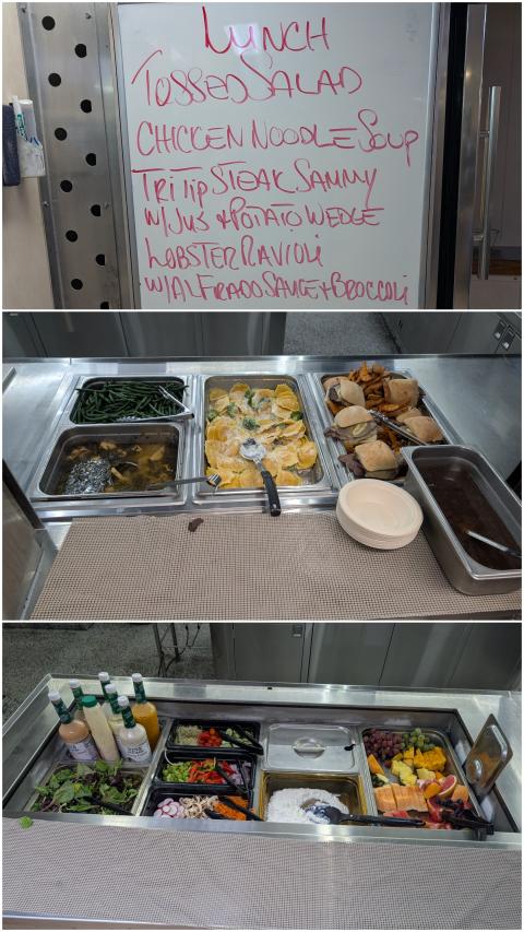
Example lunch menu and the hot and cold buffet trays. We serve ourselves, then split our compost/trash and place the plateware in the dirty bin. Photo credit: Jason Philtron
I recently read the Trader’s Tales series by Nathan Lowell. It is a sci-fi story about space ships and the folks traveling on them that draws a lot of parallels with ships at sea. The main character, Ishmael, mentions his #1 priority as: “First, feed the crew.” I’m sure this has been said countless times in real life. Without food to fuel the crew, the ship won’t function right. This goes for the crew of the R/V ARMSTRONG as well as the science team.
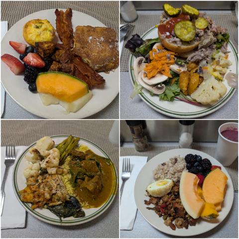
A selection of several plates. Delicious! Photo credit: Jason Philtron
The food we’ve had on this cruise is amazing! A special shout-out to Eric, Sam, and Thomas for making it happen. Every meal is served buffet-style, with both hot and cold options (see pictures). There are multiple protein, carb, and veggie choices, in addition to a full fruit and salad spread. These great meals fuel our bodies and minds so we can get the science done.
Jason Philtron
Penn State
17 September 2026
Although the Armstrong operates around the clock, a longer cruise with many different teams operating onboard allows for some downtime. I’ve been enjoying using this time as a unique opportunity to look for pelagic seabirds.
While some seabirds can easily be seen from shore, pelagic seabird species like shearwaters, storm-petrels, and albatrosses spend weeks, months, or sometimes years over the open ocean, even sleeping at sea. Since they spend so much time offshore, traveling by vessel is one of the best ways to encounter them.
So far on our cruise, we’ve encountered 6 different pelagic seabird species! The most abundant has been the great shearwater (Figure 1), which we saw in large groups flying off our back deck all day yesterday. These birds are currently on a lengthy journey to their breeding grounds on remote islands nearly 2,000 miles south of the equator in the South Atlantic. While less common, we’ve also had sightings of two other shearwater species: Cory’s and Manx.
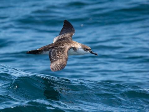
Figure 1. Greater shearwater off AR103 back deck. Photo credit: Daryll Carlson
Other pelagic seabird sightings include a group of red-necked phalaropes, small shorebirds that winter at sea; a handful of northern fulmars, close relatives of albatrosses; and Wilson’s storm-petrels (Figure 2), tiny birds that feed on plankton.
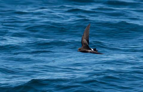
Figure 2. Wilson’s storm-petrel sighted off AR103. Photo credit: Daryll Carlson
Apart from pelagics, we’ve also had fun encounters with coastal seabird species like a double-crested cormorant that landed on our deck (Figure 3) and a pair of gulls that got into an epic battle over a fish (Figure 4).
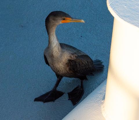
Figure 3. Double-crested cormorant on deck of AR103. Photo credit: Daryll Carlson
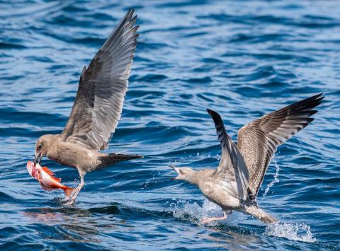
Figure 4. Epic gull battle off AR103. Photo credit: Daryll Carlson
And finally, the most interesting bird we’ve seen isn’t a seabird at all! We’ve had three merlins land on the vessel. These small birds of prey hunt other small birds, and there are documented instances of merlins catching birds on ships far offshore. Our merlins may be hanging around waiting to snag a few of the many small birds that use boats as places to rest during their migratory journeys.
We’re still early in our cruise, so cross your fingers for some other cool bird visitors as we continue along!
Daryll Carlson
University of New Hampshire
Life of the party!
Every group of scientists on this cruise is using sound to study some part of the Gulf of Maine, and my group is no exception. But we’re using sound a bit differently than the others – as we’re interested in some of the smaller creatures that live in the water column – the fish and the zooplankton. If you don’t know, zooplankton are small animals (“zoo”) that can be moved around by ocean currents (“plankton”). The fish and zooplankton are pelagic animals, meaning that they spend all (or nearly all) of their life floating or swimming in the ocean. There are many different types of zooplankton that you can find in the ocean – some are crustaceans (related to crabs, shrimp, and other decapods), some are pteropods (related to snails and slugs), and others are made of very squishy material (jellyfish and other gelatinous zooplankton). The zooplankton in the Gulf of Maine play a very important role in the ecosystem because they eat the small floating plants (phytoplankton) and in turn are eaten by lots of different types of animals like fish, seabirds, and baleen whales. So it’s important for us to know how much zooplankton are in the Gulf of Maine (and what types there are) so we can better understand how the food web here works, and how it reacts to changes in the environment.
For hundreds of years, scientists have used nets -- from small handheld ones to very large ones that could catch a school bus -- that are dragged through the water column, brought up to the ship, and then the contents of what was caught are examined in a laboratory on the ship. And we did that here on the ship last night! We towed a small ring net (about 2 feet in diameter) with a fine net mesh (it would catch poppy seeds, but not things smaller than that) from 200 m (that’s how long two football fields are) below the surface of the ocean up to the surface. We caught a lot of copepods, some gelatinous zooplankton, and even a juvenile butterfish. Copepods are very important zooplankton – they are small crustaceans (about the size of a grain of rice) but they can be very abundant and occur in every marine environment that we know! North Atlantic right whales (a critically endangered and protected species) feed exclusively on copepods and often show up in places where there are lots of copepods for them to eat.
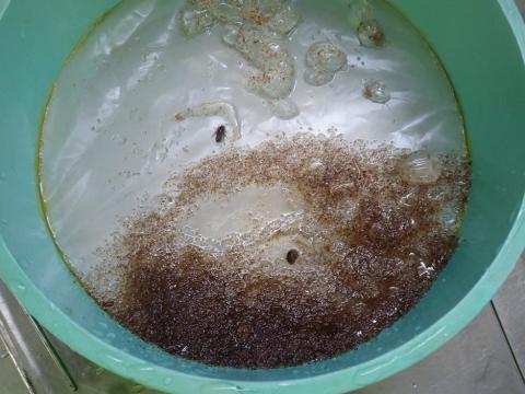
Figure 1. Sieve of contents of small ring net on AR103. Photo credit: Joe Warren
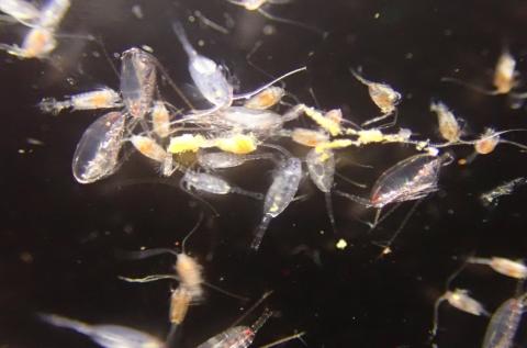
Figure 2. Copepods from small ring net on AR103. Photo credit: Joe Warren
When we bring the net back on the ship, we have to filter out the animals from the seawater so we use a sieve (green thing in the photo to the left). All the brown/red stuff near the bottom are copepods and other small zooplankton (including amphipods, arrow worms, ctenophores, and parts of siphonophores). If we take some of the copepods and put them in a small dish of seawater, get our camera out, and hold everything very still (which is very hard to do on a boat), then we can get some pretty amazing pictures of what these animals look like up close (photo to the right).
In addition to the very small things, we also caught some larger things including a juvenile butterfish (below left) and a jellyfish (mauve stinger, below right). While we were doing our net tows, we also saw squid and other small fish swimming around on the surface, but they are too quick for us to catch in our relatively small net.
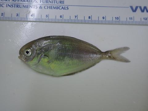
Figure 3. Juvenile butterfish on AR103. Photo credit: Joe Warren
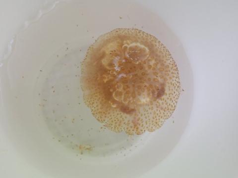
Figure 4. Jellyfish on AR103. Photo credit: Joe Warren
We are also using an underwater microscope (which we call the ZIPPER - Zooplankton Imaging Profiler and Physical Environment Recorder) and acoustic instruments called fishery echosounders to learn more about where animals are in the ocean and how many of them are there. But that’ll be covered in a different blog post later on in the cruise.
Joe Warren
Stony Brook University
for more information about the research we do, visit my lab’s webpage: https://you.stonybrook.edu/warren/
One of the best parts of being at sea on a research cruise is that there’s always something fascinating happening. Even on days when we’re primarily just steaming toward our next work site, the ocean keeps handing us new measurements, new puzzles, and new stories from beneath the waves.
We started our second day still in transit, but that doesn’t mean we were idle. As we move toward our planned survey area, we’re already collecting valuable information about the ocean— and, for our team, about the sea floor itself using acoustic (sound-based) technology. Today we’re running Kongsberg’s SBP‑29 sub‑bottom profiler along with several multibeam sonar systems. Part of this testing is simply an engineering check: we want to see how much interference or “crosstalk” occurs when multiple acoustic systems are operating at the same time. If they step on each other too much, it could limit what we can do at our main test site. However, the other part of these measurements is pure scientific gold. Every mile we travel gives us a new (and often first) snapshot of the sub-seabed under the research vessel.
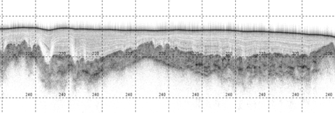
Figure 1. Seabed profile taken with the SBP-29 on AR103. Image credit: Chad Smith
This figure shows a seabed profile taken with the SBP-29— essentially an ultrasound of the ocean floor. The profile assembles a roughly continuous acoustic cross-section image showing many layers of sediment, bedrock, and buried structures beneath the seafloor. Those horizontal layers you see are geological features, each one telling a story about how the seafloor was formed, while the intensity of the acoustic reflection from each layer helps geoacoustic scientists estimate the acoustic impedance (how much a material resists a sound wave trying to pass through it), speed of sound (how fast a sound wave travels through a substance), and other geoacoustic parameters of the seabed.
Geoacoustic information about the seabed around the world is crucial for understanding how well sound travels long distances underwater and improving our understanding of how shipping and other human-generated noise, as well as global climate change, impact our oceans and its wildlife. It’s astounding the number of fields related to this type of measurement, and these “measurements of opportunity”, taken along a track that may not be of current interest to the scientists aboard this vessel, will help create a more complete mapping of the sub-seabed of our world’s oceans as a whole.
And of course, another highlight of being on a research cruise is lunch (!), because even on a research cruise, good food and a break with the team are part of what makes the work so rewarding.
Fair winds and following seas,
Chad Smith
The Pennsylvania State University
Hello! In about 2 hours, the R/V Neil Armstrong will depart from the Woods Hole Oceanographic Institution dock for a 21-day research expedition in the Gulf of Maine. I’m Jennifer Miksis-Olds (University of New Hampshire), the Chief Scientist for this research cruise funded by the Office of Naval Research. Our cruise number is AR103, which indicates that we are aboard the R/V Armstrong (AR) on its 103rd operational cruise since it was built. You will be able to track our progress over the next 3 weeks at https://www.whoi.edu/what-we-do/explore/ships/ships-neil-armstrong/neil-armstrong-tracker/. We have multiple groups onboard from University of New Hampshire, JASCO Applied Sciences, Applied Research Lab at Penn State, Portland State University, Stony Brook University, and the US Geological Survey.
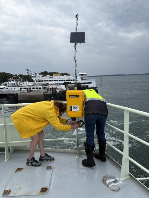
Figure 1. Installation of bat detector on AR103. Photo credit: Jen Miksis-Olds
Yesterday and this morning were devoted to preparing for departure. A large collection of research equipment was craned onto the ship, and researchers worked to set up the main lab and work space. Over the next three weeks, we will conduct biological zooplankton and fish sampling, recover/download data and redeploy four ocean bottom landers, conduct seafloor characterization surveys, and acquire sediment cores from the ocean bottom. One unique addition to the AR103 research effort is the installation of a bat detector (Figure 1) to detect bats flying offshore far from land over the Gulf of Maine. This work is being done in collaboration with Merra Howe from the Biodiversity Research Institute.
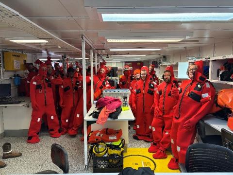
Figure 2. AR103 participants in survival suits. Photo credit: Jen Miksis-Olds
This morning focused on safety at sea. All of the ship and science crew went through a vessel safety briefing (which entails donning brightly colored survival suits in the case of a ship emergency, Figure 2), fire drill, and abandon ship drill. Safety is always the first priority, and all on the vessel take this responsibility seriously.
We will continue to blog every day to share our progress, victories, challenges, and life aboard the RV Armstrong. Here is wishing for calm seas and productive research😊
Jen Miksis-Olds
Chief Scientist, AR103
Contact us
Shelf to Shore Project Lead: Jennifer L. Miksis-Olds, PhD.
Director, Center for Acoustics Research and Education
Research Professor, School of Marine Science and Ocean Engineering | Center for Coastal and Ocean Mapping
University of New Hampshire
213 Morse Hall, Durham, NH 03824
603-862-5147
j.miksisolds@unh.edu
https://eos.unh.edu/center-acoustics-research-education
project sponsor
This project is funded by the Office of Naval Research award#: N00014-25-1-2518
